2010-03-28

Duststorms 26, 27 and 28 Mars 2010

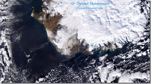
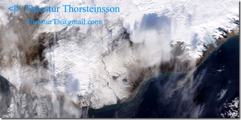
The last few days there has been a fairly strong northerly wind and duststorms visible in the southern part of the country.
20100326_sandstormur_modis_A2010085_1155
This image was taken on 26 Mars 2010, at 11:55.
20100327_sandstormur_modis_1300_crop
This image was taken 27 Mars  2010, at 13:00.
20100328_sandstormur_modis_btd_0400_crop
This temperature difference image, taken on 28 Mars 2010, at 04:00, shows a clear sign of a dust storm stemming from the sandur area in front of the glaciers Skeiðarárjökull.


Also note the black spot between Eyjafjallajokull and Myrdalsjokull, on the southern-most part of Iceland, that is the hot spot due to the eruption at Fimmvorduhals! 
2010-03-27

Eruption at Fimmvörðuháls

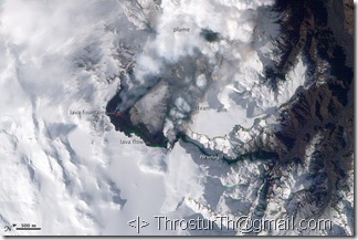
An eruption at Fimmvorduhals, between Eyjafjallajokull and Myrdalsjokull, started a week ago, just before midnight March 20th, 2010.

fimmvorduhals_ali_2010083

For latest science-related news about the eruption, check http://www.earthice.hi.is/page/ies_Eyjafjallajokull_eruption

This is a rather small eruption. There is little concern right now, but if the fissure were to widen there are glaciers on either side, and a large flood, jökulhlaup, might follow. Also, the eruption would be more explosive because water would enter the fissure.

Eyjafjallajokull’s neighbor, the mighty volcano Katla, has a history (although a short one) of following it’s neighbor closely. If that were to happen, that would most likely be an eruption of much greater concern. Katla is overlaid by Mýrdalsjökull 500 – 700 m thick over the caldera !

2010-02-23

Dust storm – smaller today 23 Feb 2010

The weather is still dry and windy, although it seems less windy today, and dust storms still apparent in satellite data.


This image from 13:00 on 23 Feb 2010 shows small plumes of dust emanating from south of Öræfajökull and from east of Mýrdalsjökull.


Aqua_1300_DUST_crop

Duststorm 22 February 2010

These days sandstorms are frequent. The weather conditions are very favorable, windy, dry and sunny (at least in the southern part of the country) for clear satellite images :-)
DUST_P20100521310_crop
These satellite images from Aqua/Terra were taken at 13:10 (above), and 13:55 (below) on Monday 22 February 2010.
DUST_P20100531355_crop
Vestmannaeyjar are in the middle of the plume from (just to the left of center of the image, the island south of the main island). Would be fun to hear from people there, get pictures and see data from sand traps :-)

2010-02-22

Dust storm on February 21 and 20th

Dust storms on February 21st.

1143_D52_T1255_DUST

This image taken at 12:55 - 13:00 shows

2143D52_T1310_DUST

This one is taken at 13:10 - 13:15.


And, although more cloudy on February 20th, we can see similar sources.

D51_DUST

Taken on February 20 around 12:10.