2012-05-29

Still some ash and dust blowing around

Yesterday, 28 May 2012 a satellite image showed a dust storm originating north of Dyngjujökull, near Jökulsá á Fjöllum. Whether this event, or the sum of many before it, the northern part of Vatnjökull is visibly brownish in the area near this source of dust storms.
20120528_modis_1250_crop
Image from 12:50 Monday 28 May 2012 (NASA/Rapidfire).
Today in Fljótshverfi, east of Kirkjubæjarklaustur (underneath western part of Vatnajökull), PM10 went well over 50 micro-g/m3, up to, and over, 150 micro-g/m3.
Capture
The forecast is for sunny, dry, days, so we can expect more of this if winds pick up – and not by that much.

2012-05-22

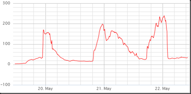
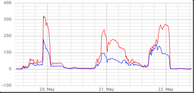
High concentration of Particulate Matter around midnight past few days in Reykjavik due to ash re-suspension and dust storms

There has been a lot of ash and dust blowing around the southern part of Iceland the past few days. Sunny and dry, and not much wind needed to re-suspend the ash for instance.

Mainly in the evening that we have had high PM10 concentration here in Reykjavik area. This can be clearly seen from measurements at Grensásvegur, Kópavogur and Hvaleyrarholt.

In the south, at Raufarfell, there was a lot of PM10 mid-day 21 May 2012.

GRE_19_22_may_2012_PM10_capture 
Grensás.

HHK_20_22_may_2012_PM10_PM25_capture 
Kópavogur (HHK).

Hvaleyrarholt_20_22_may_2012_PM10_capture 
Hvaleyrarholt.

Raufarfell_21_may_2012_PM10_capture 
Raufarfell, south of Eyjafjallajökull.

2012-05-20

Ash re-suspension and dust storm on 20 May 2012

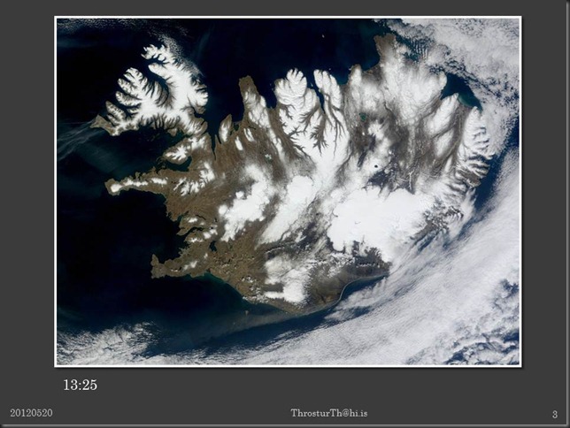
Few pictures, and PM10 data, from ash- and dust storms on 20 May 2012.

Slide1

Slide2

Slide3

Slide4

Images from NASA/Rapidfire/EOS via IMO.

2012-05-14

Dust and ash storms even more visible

Satellite image since 14:15 today shows the dust and ash storms well.

20120514_modis_1415_crop

Dust storms in cold dry weather and strong winds

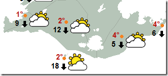
Yesterday, today, and probably for the next couple of days, we expect dust storms off the sandur and ash fallout areas in the south of Iceland. There is no rain in forecasts in the south till Friday, and tomorrow the forecast is for a strong northerly wind still (13 m/s), then more SE at 7 m/s on Wednesday, which might be enough.

At noon today the weather map looked like this (en.vedur.is)

image At 12 on Monday, 14 May 2012.

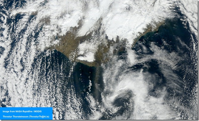
Satellite image from 12:20 today shows a dust storm just east of Mýrdalsjökull.

20120514_modis1220_crop

Yesterday, around 15:10 there was also a dust/ash storm visible.

20120513_modis_1510_crop